🌈Earth Systems Science Unit 17 Review
17.1 Satellite-based Earth observation systems
17.1 Satellite-based Earth observation systems
Unit & Topic Study Guides
Earth Systems Science: An Introduction
Earth's Structure and Composition
Plate Tectonics: Earth's Dynamic Crust
Earthquakes & Volcanoes: Earth's Geohazards
Weathering, Erosion & Soil Formation
Hydrologic Cycle & Freshwater Systems
Ocean Circulation & Marine Ecosystems
Atmosphere: Composition and Structure
Weather Systems and Climate Patterns
Biogeochemical Cycles: C, N, and P
Terrestrial Biomes and Ecosystems
Climate Change & Air Pollution Impacts
Water Resources and Pollution
Human Impacts on Land and Soil
Biodiversity Loss: Human Impact & Conservation
Earth Systems: Interactions & Feedbacks
Earth Observation & Remote Sensing Technologies
Earth Systems Modeling: Methods & Uses
Sustainable Resources and Policy
Satellite Orbits and Positioning
Satellite-based Earth observation systems give scientists a way to monitor the planet continuously and at scales that ground-based instruments can't match. Understanding how these satellites are positioned, and what sensors they carry, is central to modern Earth systems science.
Earth Observation Satellites and Their Orbits
Earth observation satellites collect data about the planet's surface and atmosphere from space. Where a satellite is placed in orbit determines how much of the Earth it can see, how often it revisits the same spot, and what kind of data it can collect. Two orbit types dominate Earth observation:
Geostationary orbit places a satellite roughly 36,000 km above the equator. At that altitude, the satellite's orbital period matches Earth's rotation, so it appears to hover over the same point on the surface. This makes geostationary satellites ideal for continuous monitoring of a fixed region. Weather satellites like GOES (U.S.) and Meteosat (Europe) use this orbit to track storm development in near-real time.
The tradeoff is spatial resolution. Because the satellite sits so far from the surface, each pixel covers a relatively large area.
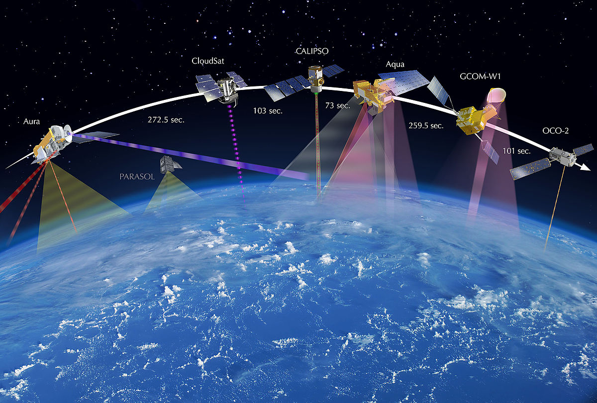
Polar orbits send satellites on a roughly north-south path over the poles at much lower altitudes (500–800 km). As the Earth rotates beneath the satellite, successive passes cover different strips of the surface, eventually imaging the entire globe. Most polar-orbiting satellites are also sun-synchronous, meaning they cross any given latitude at the same local solar time each orbit. This keeps lighting conditions consistent between passes, which matters for comparing images over time.
- Used for global mapping, environmental monitoring, and weather forecasting
- Lower altitude means higher spatial resolution than geostationary satellites
- Revisit times typically range from days to weeks, depending on the mission

Global Positioning Systems
GPS (Global Positioning System) is a satellite-based navigation system developed by the United States. It relies on a constellation of 24+ satellites that continuously broadcast precise timing and location signals. A GPS receiver on the ground picks up signals from multiple satellites and calculates its own position by measuring the time delay of each signal. With signals from at least four satellites, the receiver can determine latitude, longitude, altitude, and time.
GNSS (Global Navigation Satellite System) is the umbrella term for all satellite navigation constellations worldwide:
- GPS (United States)
- GLONASS (Russia)
- Galileo (European Union)
- BeiDou (China)
Using signals from multiple GNSS constellations at once improves accuracy and reliability, especially in areas where buildings or terrain block part of the sky. In Earth science, high-precision GNSS measurements are used to track tectonic plate motion, measure land subsidence, and monitor changes in ice sheet elevation.
Remote Sensing Technologies
Remote sensing falls into two broad categories based on whether the sensor provides its own energy source. Active sensors emit a signal and measure what comes back. Passive sensors detect natural energy (usually reflected sunlight or emitted thermal radiation) from the Earth's surface.
Active Remote Sensing Techniques
Synthetic Aperture Radar (SAR) transmits microwave pulses toward the surface and records the backscattered energy. Because microwaves pass through clouds, fog, and smoke, SAR can image the surface in any weather and at any time of day or night.
SAR is especially valuable for:
- Mapping surface deformation (e.g., ground displacement after an earthquake, measured to millimeter precision using a technique called InSAR)
- Monitoring sea ice extent and movement
- Estimating forest biomass by measuring how much signal penetrates the canopy versus scatters off it
The "synthetic aperture" part of the name refers to how the satellite's motion along its orbit is used to simulate a much larger antenna, which sharpens the image resolution far beyond what the physical antenna size would allow.
LIDAR (Light Detection and Ranging) fires rapid laser pulses toward the surface and measures how long each pulse takes to return. That travel time is converted to a distance, and thousands of these measurements build up a detailed 3D point cloud of the terrain.
How LIDAR data collection works:
- The sensor emits short laser pulses (often thousands per second)
- Each pulse reflects off surfaces at different heights (treetops, branches, ground)
- The sensor records the return time and intensity of each reflection
- Combined with GPS positioning of the aircraft or satellite, these returns are mapped into precise 3D coordinates
Applications include topographic mapping, forest canopy structure analysis, flood risk modeling, and coastal erosion monitoring. NASA's ICESat-2 mission uses spaceborne LIDAR to measure ice sheet elevation changes with centimeter-level precision.
Passive Remote Sensing Techniques
Multispectral imaging captures reflected energy in several discrete wavelength bands across the electromagnetic spectrum, typically including visible light, near-infrared (NIR), and shortwave infrared (SWIR). Different surface materials reflect these wavelengths differently, which is what makes classification possible. Healthy vegetation, for example, absorbs red light for photosynthesis but strongly reflects NIR, producing a distinctive spectral signature.
- Landsat (NASA/USGS) and Sentinel-2 (ESA) are widely used multispectral platforms
- Common applications: land cover classification, agricultural health assessment, water body mapping, and urban expansion tracking
- Typically captures data in around 4–12 bands
Hyperspectral imaging takes this further by collecting data across hundreds of narrow, contiguous spectral bands. Where a multispectral sensor might have one broad "red" band, a hyperspectral sensor records dozens of fine slices through the red portion of the spectrum alone. This produces a nearly continuous reflectance spectrum for every pixel.
That level of spectral detail allows you to distinguish materials that look identical in multispectral data. Applications include mineral identification for geological exploration, detecting subtle vegetation stress before it's visible to the eye, and assessing water quality parameters like chlorophyll concentration or sediment load.
Active vs. Passive at a glance: Active sensors (SAR, LIDAR) supply their own energy, so they work day or night and often through clouds. Passive sensors (multispectral, hyperspectral) depend on sunlight or thermal emission, so they're limited by cloud cover and daylight, but they capture rich spectral information across many wavelengths.