AP Human Geography Unit 1 Cheatsheet: Thinking Geographically

AP Human Geography Unit 1 Cheatsheet: Thinking Geographically

Start with the first 3 sections of the Unit 1 one-page cheatsheet below. The full sheet is a PDF you can print.

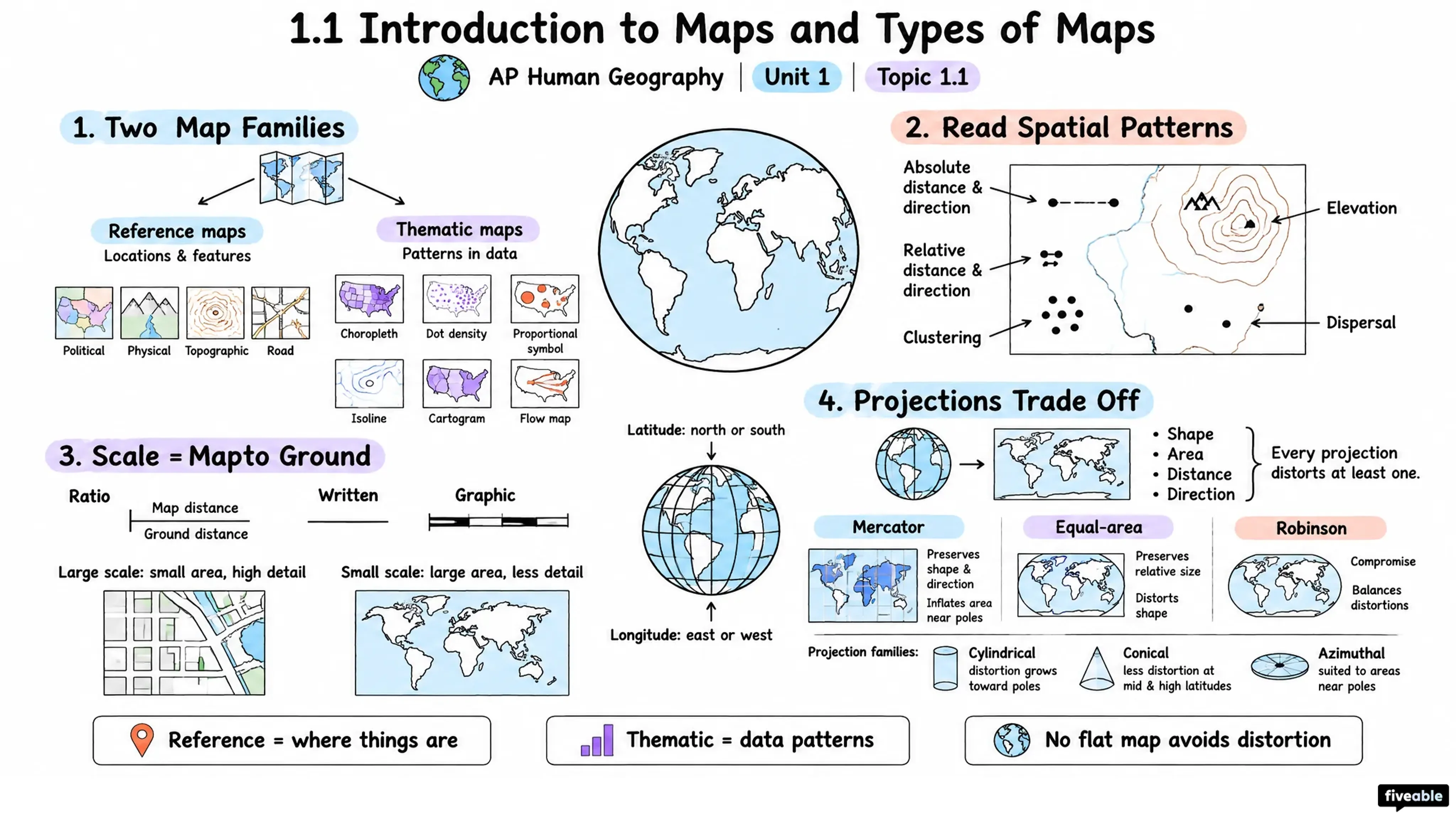
Map Types & Distortion

Reference Maps show locations of places, features, and boundaries (political, physical).

Thematic Maps display spatial distribution of a specific phenomenon (population density, climate, language).

All maps distort because Earth is spherical; projections inevitably sacrifice accuracy in shape, area, distance, or direction. No projection is perfect—choose based on purpose.

Spatial patterns on maps:

  • Absolute distance/direction (measured in units)
  • Relative distance/direction (perceived, contextual)
  • Clustering (concentration)
  • Dispersal (spread out)
  • Elevation (relief)

Data Collection Methods

Non-technology (qualitative) sources: field observation, landscape analysis, personal interviews, and photographic interpretation (photos may be ground-level, aerial, or satellite).

Written sources: Travel narratives, media reports, policy documents, field notes.

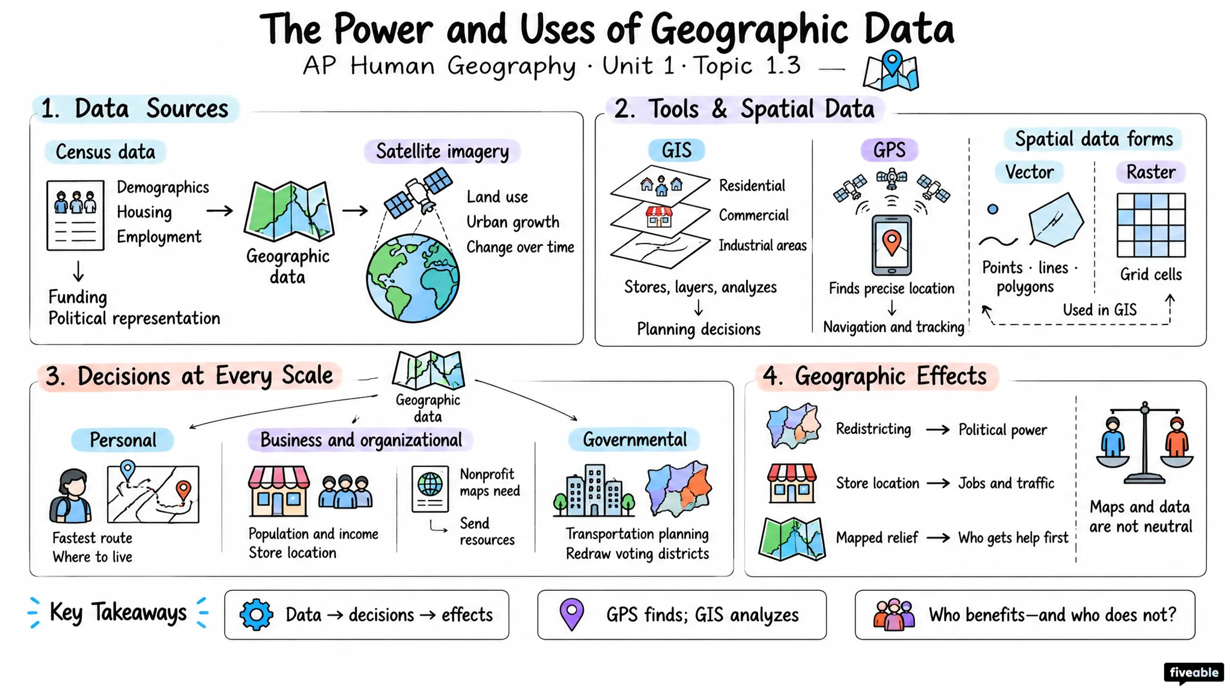
Geospatial technologies:

  • GIS (geographic information systems)
  • Remote sensing (satellite/aerial imagery)
  • GPS/satellite navigation
  • Online mapping & visualization tools

Data gathered by organizations, governments, or individuals at any scale.

Core Spatial Concepts

Absolute location: Precise coordinates (latitude/longitude).

Relative location: Position in relation to other places ("near the coast").

Space: Area or expanse; how phenomena are distributed across Earth.

Place: Specific location with meaning, identity, and human attachment.

Flows: Movement of people, goods, ideas, capital across space.

Distance decay: Interaction decreases with distance; closer places interact more.

Time-space compression: Technology reduces effective distance; places feel closer.

Pattern: Spatial arrangement of phenomena (clustered, dispersed, linear).

The rest of the Unit 1 sheet

6 more sections are on the one-page PDF:

  • Geographic Data in Decision-Making

  • Region Types & Boundaries

  • Map Selectivity & Interpretation

  • Scales of Analysis

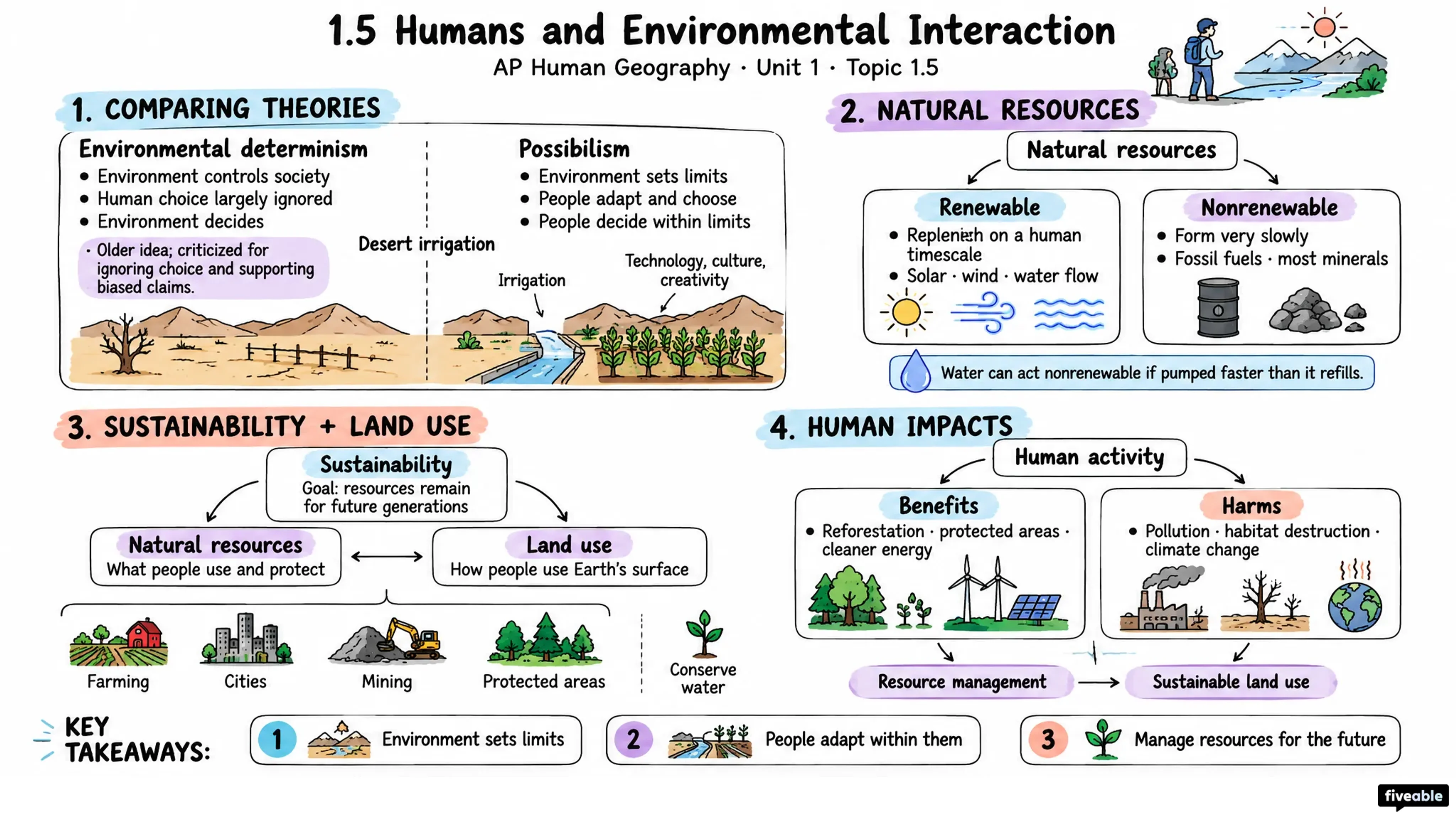
  • Human-Environment Interaction

  • Connecting Concepts: Why Geography Matters

Made by you

Visual Cheatsheets

Pick a Unit 1 topic and a format: flowchart, comparison chart, vocab sheet, Cornell notes and more. Ready in about a minute.

Printable PDF · from the Fiveable shop

AP Human Geography Unit 1 Cheatsheet

1 page · Thinking Geographically · PDF

Visual Cheatsheets

One topic, the format you pick, ready in about a minute

Format

Topic

Takes 30–60 seconds

Preview: Standard

Unit 1: Thinking Geographically, topic by topic

Each topic has a full study guide. See the whole unit.