Made by you
Visual Cheatsheets
Pick any topic and a format: flowchart, comparison chart, vocab sheet, Cornell notes and more. Ready in about a minute.
Make a visual cheatsheet for any Geospatial Engineering topic in the format you study best with.
Made by you
Pick any topic and a format: flowchart, comparison chart, vocab sheet, Cornell notes and more. Ready in about a minute.
One topic, the format you pick, ready in about a minute
Format
Topic
Takes 30–60 seconds
Preview: Standard
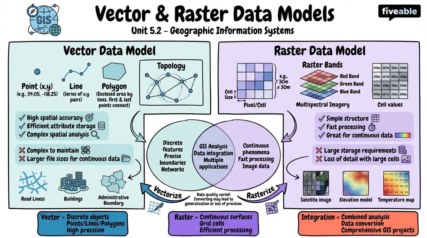
5.2 Vector and raster data models
Standard
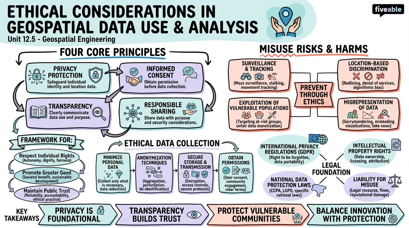
12.5 Ethical considerations in geospatial data use and analysis
Standard
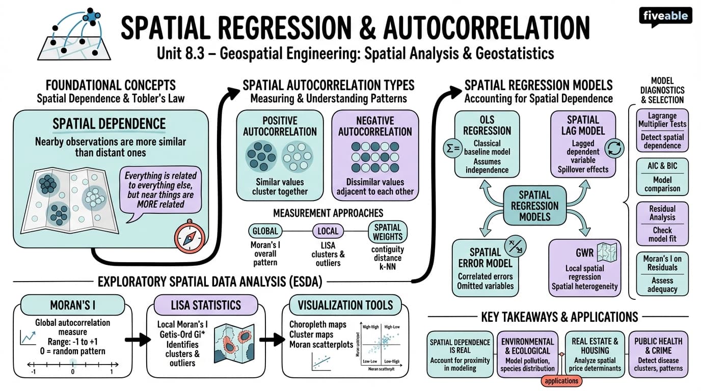
8.3 Spatial regression and autocorrelation
Standard
A cheatsheet condenses a whole course into the facts you actually need on exam day. The Geospatial Engineering cheatsheets on this page summarize the key formulas, concepts, and definitions from each unit so you can review the entire course at a glance.
They work best as a final review: skim the one-page summary, spot the units you want to strengthen, then go deeper with the Geospatial Engineering study guides. The visual cheatsheets in the gallery are organized by unit, and you can generate your own for any topic you want a quick refresher on.