🚜AP Human Geography
🚜AP Human Geography
FRQ 3 – Two Stimuli
Unit 1: Thinking Geographically
Practice FRQ 1 of 31/3
3. Respond to parts A, B, C, D, E, F, and G.
A.
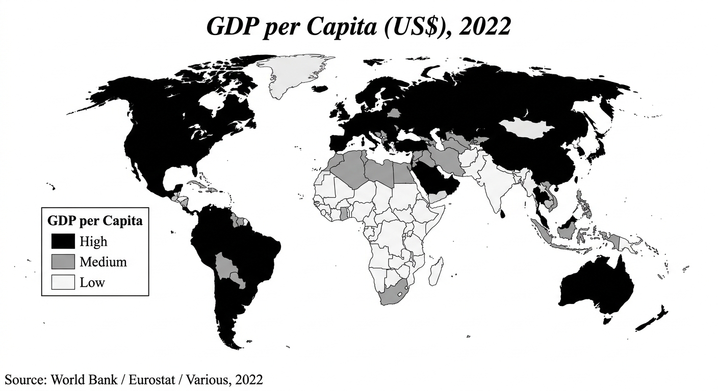
Identify the type of map shown in Map 1.
B.
Describe the spatial pattern of countries with high GDP per capita shown on Map 1.
C.
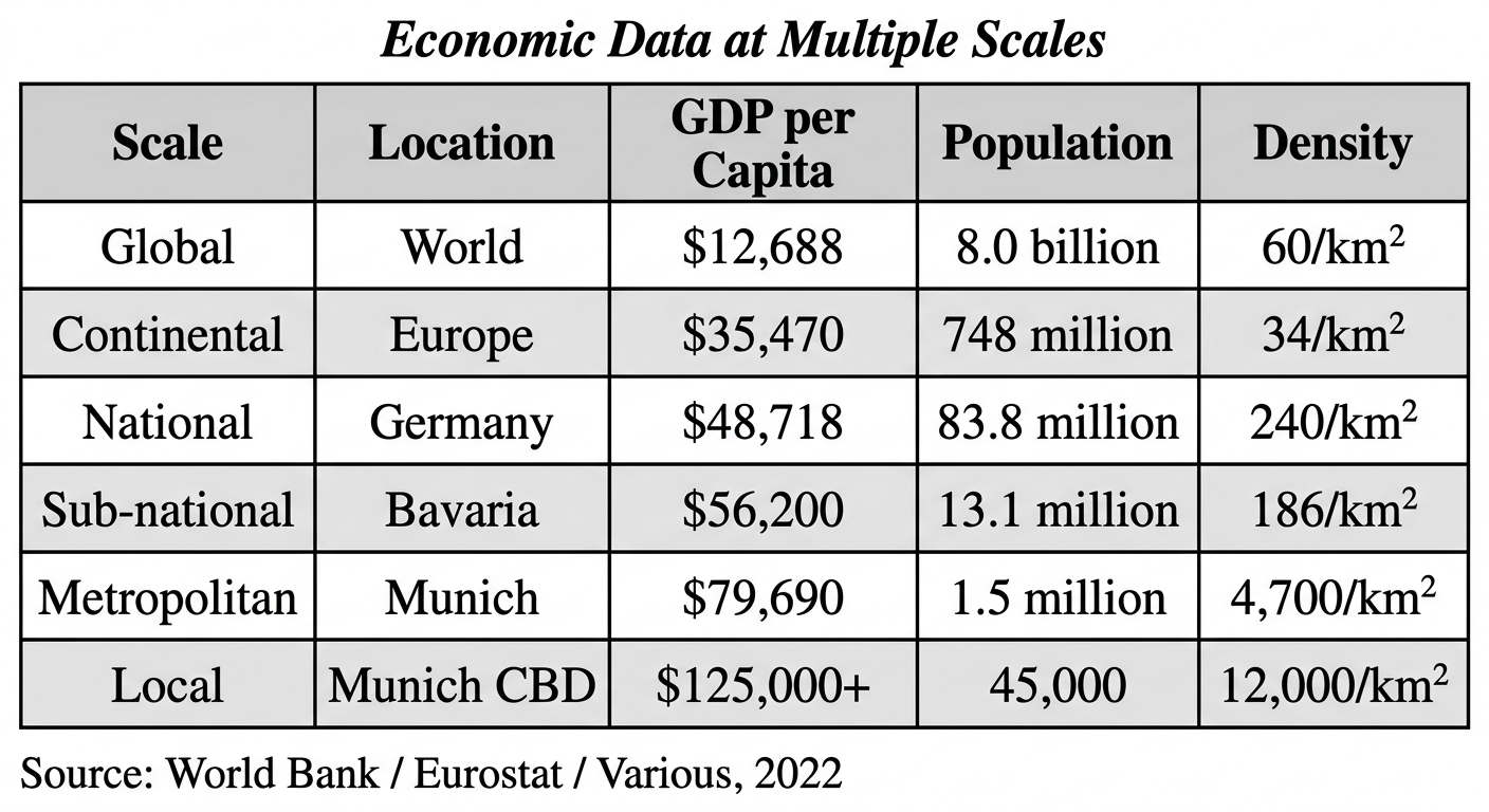
Based on Map 1 and the table, compare the representation of Germany's economic development on the map with its representation in the table. (Response must include both the map and the table in the comparison.)
D.
Describe the concept of a formal region.
E.
Explain one way governments collect the demographic data shown in the table.
F.
Explain how governments might use local scale economic data to make policy decisions.
G.
Using the data from the table, explain the relationship between population density and economic development.